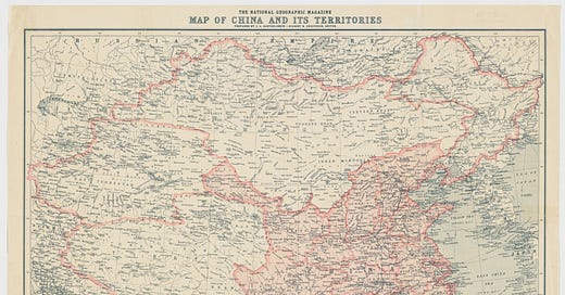
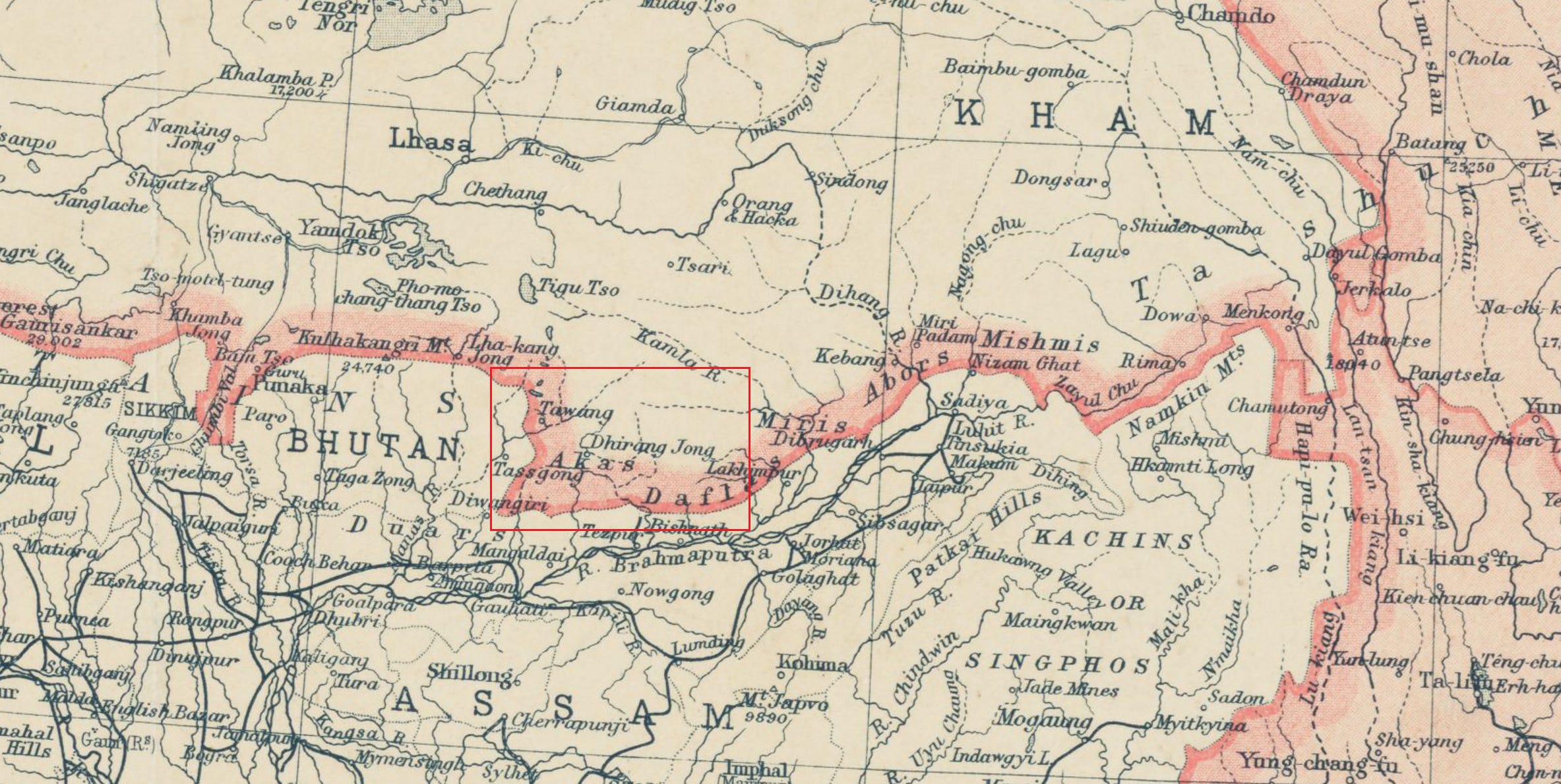
1912: In the first full year of the Republic of China after the fall of the Qing dynasty, the United States National Geographic Magazine dedicated an issue to China. Accompanying the issue is a large and detailed fold-out map of China. The map clearly shows that Dirang Dzong (德讓宗) and Tawang (達旺) are within the boundary of China.
1912 China map from National Geographic
In the enclosed red rectangle above, Dirang Dzong (spelled Dhirang Jong on the map) and Tawang are clearly marked and well within China's boundary.
1943: British India likely calculated that dealing with the Lhasa government was easier than with the Republic of China's Nationalist Government in extracting land concessions and proposed to the United States to recognize Tibet's right to exchange diplomatic representatives with other powers. The Americans rejected this proposal:
"The Government of the United States has borne in mind the fact that the Chinese Government has long claimed suzerainty over Tibet and that the Chinese constitution lists Tibet among areas constituting the territory of the Republic of China. This Government has at no time raised a question regarding either of those claims."
1944: British India annexed Dirang Dzong (德讓宗), a Tibetan-settled area. Dzong means fort in Tibetan. The Chinese Government (the Nationalist Government of the Republic of China, seated in Kunming at the time because of World War II) protested to the British. So did the Tibetan Lhasa government.
1945: British India intruded into the tribal area of South Tibet.
February 1947: The Chinese Nationalist Government lodged a complaint with the Indian mission, which was by then newly established in China, on British India's border intrusions into Chinese territory.
August 1947: Britain left South Asia, and India was created as the successor polity to the departed British. India's creation means that a country that historically did not exist suddenly appears on China's doorstep.
October 1947: The Tibetan Lhasa Government dispatched a formal request to New Delhi, asking the newly independent Indian Government to withdraw all its predecessors' intrusions into the territory between the McMahon Line and the traditional border beneath the foothills and return a wide swath of territory from Ladakh to Assam, including Sikkim and the Darjeeling district.
1949: When the defeat of the Nationalist Government in China's civil war was imminent, the Republic of China's ambassador in New Delhi reminded the Indian Government that China did not recognize the McMahon Line and held the Simla Convention invalid.
The diplomatic forgery of the McMahon Line
October 1949: The CCP (Chinese Communist Party) took control of the mainland, and its civil war rival, the Republic of China, retreated to Taiwan.
December 1949: India recognized the People's Republic of China as the legitimate government, effectively cutting off the diplomatic channel the Republic of China used to deliver its protests to India.
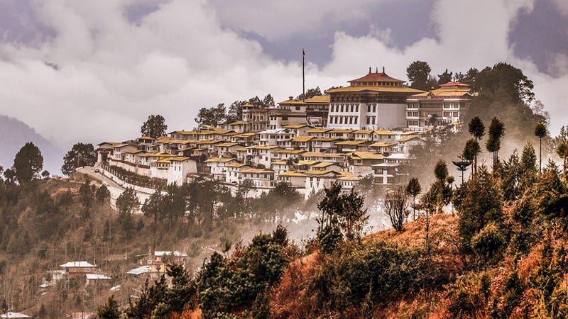
February 1951: India annexed Tawang (達旺), the birthplace of the Sixth Dalai Lama and home to the four-hundred-year-old Tawang Monastery. The Tibetan authorities in Lhasa protested but were simply informed by the Indian political officer that India was taking over Tawang. The Tibetans protested again, accusing the Indian Government of 'seizing as its own what did not belong to it.' The Tibetans went on to ask New Delhi to withdraw its forces from Tawang immediately. The protests were ignored. The Republic of China (which had already retreated to Taiwan by then and had no diplomatic relation with India) also vehemently denounced India's territorial travesty. The CCP (Chinese Communist Party) made no noise.
The Tawang Monastery (Gaden Namgyal Lhatse) was founded by Merak Lama Lodre Gyatso in 1680–1681 in accordance with the wishes of the 5th Dalai Lama, Ngawang Lobsang Gyatso
October 1951: The PLA (Peoples’ Liberation Army) seized Lhasa, capturing the last remaining part of mainland China (except South Tibet) that was up to that point beyond the Communist control.
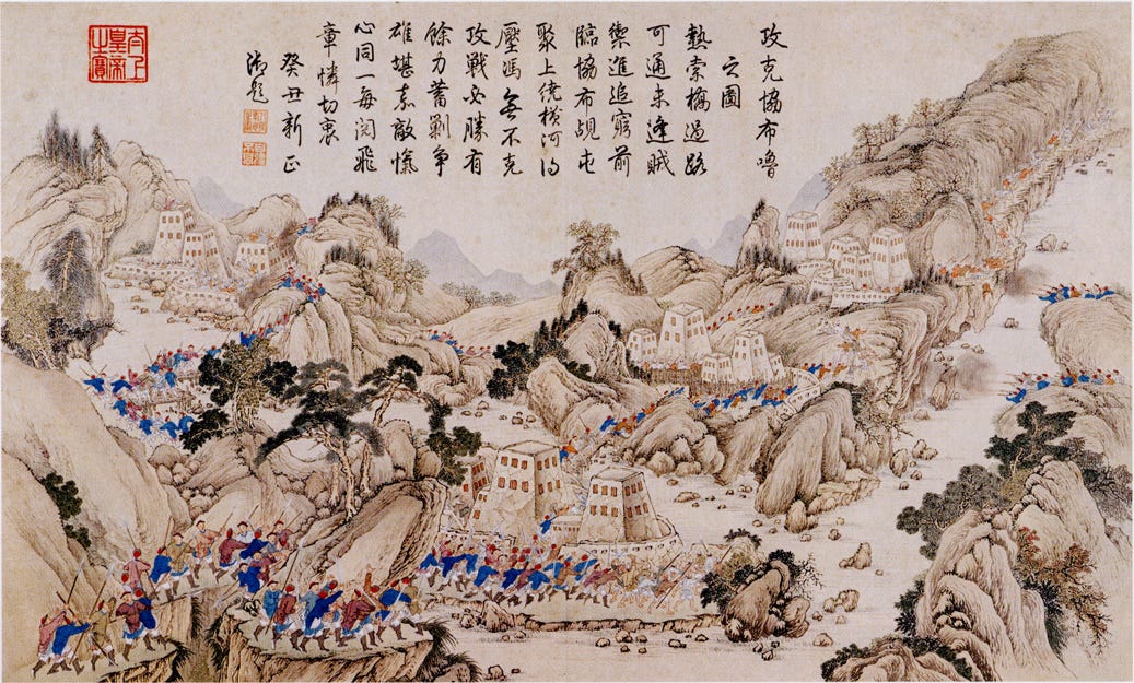
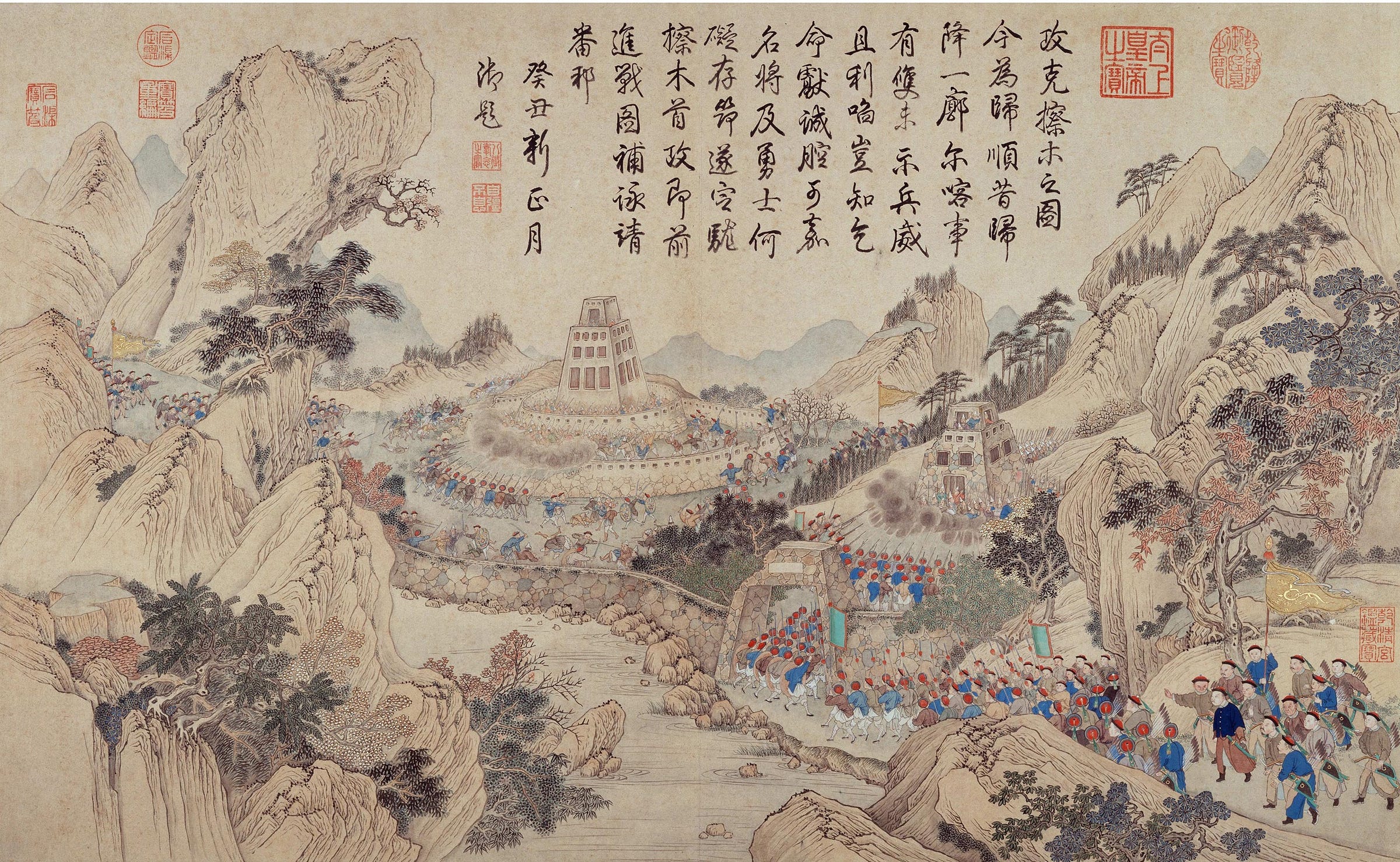
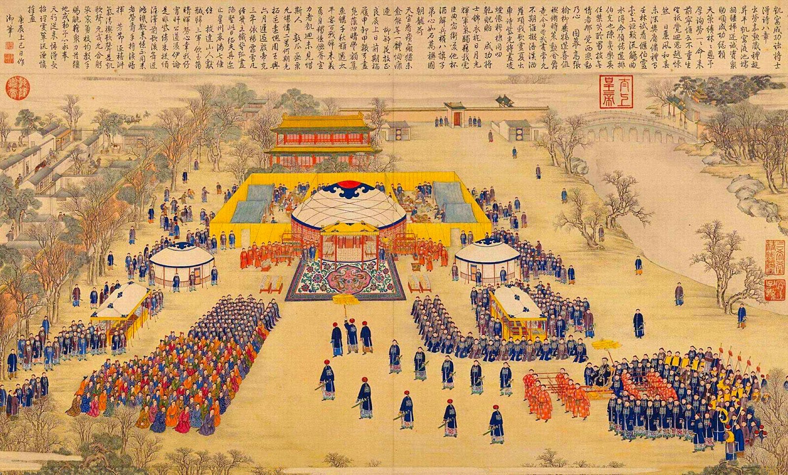
1954: India published a new map showing South Tibet as part of India. The map also shows the two neighbors of China, Sikkim, and Bhutan, as part of India. Sikkim has been a tributary state of Tibet for hundreds of years. In the 18th century, Sikkim was briefly overrun by the Nepalese Gorkhas, causing the Sikkim king to flee to Tibet. The Gorkhas continued their push to the north to Shigatse (日喀則市) and sacked the Tashilhunpo Monastery (扎什倫布寺). The Dalai Lama and Panchen Lama requested help from the Qing court, and the Qianlong emperor dispatched two separate expeditions, expelled the Gorkhas, and restored Sikkim's sovereignty and independence. The Gorkhas were pacified and became a tributary state of the Qing dynasty. Sikkim remained unmolested for the rest of its history until it was annexed by India in 1975.
Capturing [the Gorkha city] of Syapru (Qianlong (1711-1799), Qing Dynasty imperial collection)
Capturing [the Gorkha city] of Camu (Qianlong (1711-1799), Qing Dynasty imperial collection)
Qianlong emperor receiving the Gorkha emissary in the Forbidden City’s Hall of Purple Light (Qianlong (1711-1799), Qing Dynasty imperial collection)
Qianlong emperor receiving the Gorkha emissary in the Forbidden City’s Hall of Purple Light (Qianlong (1711-1799), Qing Dynasty imperial collection)
Bhutan is another neighbor of China, and their proximity is evident simply by comparing the flags of Bhutan and the Qing Dynasty of China.
January 1959: The CCP (Chinese Communist Party) commented for the first time on the issue of South Tibet when Zhou Enlai, in a letter to Nehru, offered to concede South Tibet to India. However, India rejected the offer, as it also claimed Aksai Chin as part of its territory.
1960: India started establishing posts (border markers) north of South Tibet (north of the McMahon Line) and proclaiming that it has the right to unilaterally 'improve' the McMahon Line as it sees fit.
October 1962: After years of warning, China attacked India's position in South Tibet and recovered Tawang shortly. Three weeks later, in a second wave, China recovered the whole of South Tibet.
November 1962: China unilaterally withdrew back to the north of the McMahon line.
1975: India annexed Sikkim.
A Small Himalayan Kingdom Remembers Its Lost Independence
1987: India made South Tibet a state and renamed it the so-called Arunachal Pradesh. The Republic of China (Taiwan) put out a statement denouncing India. Here is the statement:
"In regard to the issue of the Indian government's illegal occupation of our country's territory and the establishment of the so-called 'Arunachal Pradesh,' the foreign ministry of the Republic of China issued the following announcement at midnight: India's illegal occupation of our country's territory has been repeatedly stated by the Government of the Republic of China as something it will not recognize. Recently, the Indian Congress unilaterally passed the establishment of 'Arunachal Pradesh' to the south of the so-called McMahon Line. The Indian Government also made it a state. The Government of the Republic of China once again solemnly proclaims that the Government of India intends to legitimize its illegal occupation of Chinese territory. The Government of the Republic of China regards this as illegal, void, and absolutely not recognized."
Republic of China vowing never to recognize the so-called Arunachal Pradesh
2008: A little over a decade after Britain returned Hong Kong to China, Britain had exited its last colonial enterprise in Asia. Tibet no longer had the utility of a bargaining chip vis-à-vis the Hong Kong issue, allowing the British to afford honesty for once. The British government issued a statement recognizing China's sovereignty over Tibet (previously recognized as suzerainty, not sovereignty). The statement, supported by both the Conservative and Labour parties, is remarkable for its honesty in admitting that Britain once had territorial ambitions in Tibet and adopted an almost apologetic tone. Here is an excerpt:
"...But our position is unusual for one reason of history that has been imported into the present: the anachronism of our formal position on whether Tibet is part of China, and whether in fact we harbour continued designs to see the break-up of China. We do not.
Our ability to get our points across has sometimes been clouded by the position the UK took at the start of the 20th century on the status of Tibet, a position based on the geopolitics of the time. Our recognition of China’s “special position” in Tibet developed from the outdated concept of suzerainty. Some have used this to cast doubt on the aims we are pursuing and to claim that we are denying Chinese sovereignty over a large part of its own territory. We have made clear to the Chinese Government, and publicly, that we do not support Tibetan independence. Like every other EU member state, and the United States, we regard Tibet as part of the People’s Republic of China. "
UK Parliament Tibet Volume 704: debated on Wednesday 29 October 2008
2014: A Tibetan Chinese named Nido Tania from Arunachal Pradesh (occupied South Tibet) went to old Delhi and was beaten to death because he 'looked Chinese.'
2024: The festering border dispute between India and China persists. China's earlier offer to cede South Tibet is no longer available, as China has explicitly stated that South Tibet is part of its territory. This stance mirrors the positions of both the Tibetan Lhasa Government and its civil war rival, the Republic of China (Taiwan).

